Flag shared by Peru and Ecuador and Columbia   2007 Peru / Ecuador

Machu Picchu,
the Royal Inca's Estate

by
Zweibieren

two beer mugs
left arrow Cusco
Physpics navigation right arrow Annals of Zweibieren navigation right arrow Peru/Ecuador navigation right arrow here
Quito arrow to the right

With an elevation of 2600 meters and a relentless tour guide, a visit to Machu Picchu can be disorienting. And yet the whole area is only 400x100 meters; a mere 20th of a sq km.  This page expands on my own experience and orients you to better enjoy your visit.

Almost everything about Machu Picchu is speculation, although I will use the most common terms. It seems likely that the estate was a summer retreat for the Inca, that is, for the god-ruler himself. The agricultural areas seem insufficient to feed a fully occupied village throughout a year.
The bus from Aguas Calientes to Machu Picchu runs whenever there is a full bus. The direct distance is about two and a half kilometers, but the bus has to travel about nine kilometers to ascend the mountain. The switchbacks in the image at the right run from Aguas Calientes in the upper right to Machu Picchu at the middle left. (Click for larger image.) switch backs ascending from Aguas Calientes in the upper right to Machu Picchu at the middle left

The map below is interactive. The layers can be turned on and off. The first four tabs below the map turn on selected layers. The fifth tab lets you turn them on and off yourself.
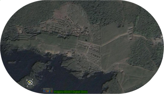
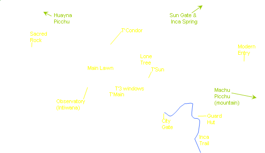
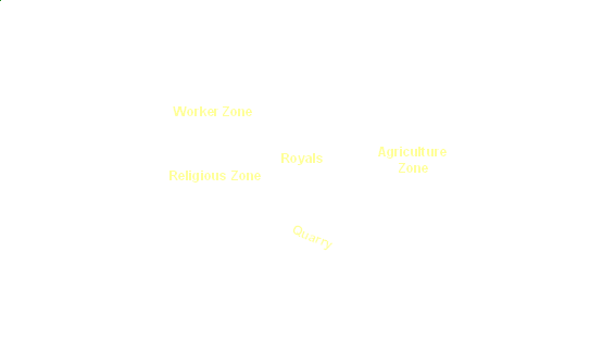
satellite image of Machu Picchudots for key features of Machu Picchunames of key features on Machu Picchunames of zones on Machu Picchu
Image adapted from greatbuildings.com

   Overview   Geography   Landmarks   Routes   Map Toggles
Upon entering Machu Picchu, your guide will take a sharp left into the woods and UP a steepish path. You climb about 50 meters, the only strenuous uphill part of the tour. The climb is worth it. You emerge from the woods to a spectacular view.

You are near the lone "Guard Hut" high on the agricultural terraces. As you look at the estate, there is a grassy area in the middle; the "Main Lawn." To its left is the "Religious area," having "temples" and little housing. Closer to you is the "Royal Area" with some housing. To the right of the lawn is the "worker area," with lots of housing. Beyond the estate is two humps of Huayna Picchu; behind you is Machu Picchu summit.

To keep oriented as you walk around, remember:
main lawn in the middle
religious area is west side
worker area is east side
Huayna Picchu is north
Machu Picchu summit is south

View from the Guard Hut, with Huayna Picchu as backdrop.
The stone village lies along a mountain ridge running roughly north/south. The ridge tails off almost vertically to the east and west. The usual view in pictures is from the south, looking north with Huayna Picchu on the right in the background. (And the smaller Wayna Huayna Picchu on the left. The mountain called Machu Picchu is behind the camera.)
Beyond the city on the right is a large hill called Huayna Picchu. To its left is a small hump known as Wayna Huayna Picchu. Behind you and far above is the summit of the mountain Machu Picchu from which the city gets its name.

From the Guard Hut the contours are obvious, and help in keeping you oriented. Clikcing the Contour button lays a color coded schematic of the contours. Ridges to left and right are above the main lawn. They peak at yellow, with green as the level of the main lawn and tailing off blue and purple down the cliffsides. The agricultural area ascends above and to the south of the guardian hut and then slopes steeply down to the east.


View from the north end. Machu Picchu peak rises in the background. Guard Hut prominent below it and above the agricultural area. The religious area is on the right, dominated by the observatory.


On the map, a T' is my shorthand for "Temple of."
Some of the main sights on the site are these:
  • City gate. End of the Inca Trail
  • Temple of the Sun. Distinctive rounded shape. You look down or up at it.
  • Temple Plaza: Main Temple & Temple of the Three windows (yes, it has three windows)
  • Observatory. The highest point on the estate.
  • Lone Tree. All alone in the middle of the southern part of the main lawn.
  • Temple of the condor. Your guide will show you its parts.
  • Sacred rock. Big slab-like affair. Plaza in front has an open hut on each side. Trail to Huayna Picchu starts here.


Intiwana or Observatory.
Hitching post to tie the sun and reverse its course at the solstice.


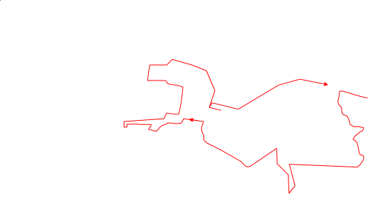
Day 1. Anna led us up to the Guard Hut. Then down through the City Gate and past the Quarry. We looked down on the Sun Temple and Proceded to the Temple Plaza to view the Main Temple and the Temple of the Three Windows. Then we climbed up to the observatory. After that we walked along the west side of the Main Lawn and then cut over to the Temple of the Condor. Returning to the west side, we visited the fountains in the Royal Area. Finally back along the west of the Main Lawn and across the Agricultural Zone to the entrance.

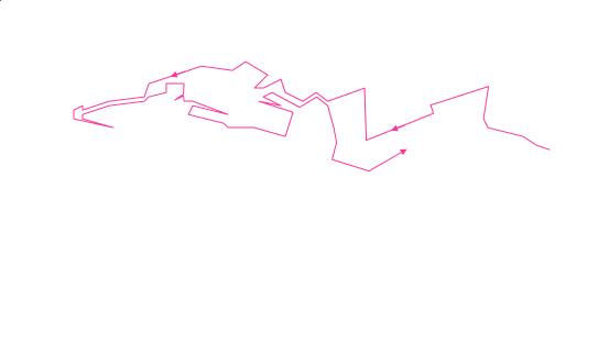
Day 2. On my own, I decided to visit the east side and its Worker Zone. I traversed the lowest edge I could and took photos in three general directions: down the hill, toward Huayna Picchu, and towarrd Machu Picchu. I once again encountered the Temple of the Condor. Then I arrived at the entrance to the Huayna Picchu trail and had to be told that the Sacred Rock I was looking for was directly behind me where I stood. I returned along the upper edge of the east side.


Click to toggle
map overlays:

Sunday, May 13, 2007

At M-P we walked upward to the "Guardian Hut" on the southern end of the site. From the vantage of the guardian hut, the mass of the settlement stretches north below ones feet. The left, or west, side is the "religious zone" and the right is a "dwelling zone." Between and lower than both is a courtyard with llamas grazing. On either side, scaling the slopes are terraced farming areas. Guarding the other end of the complex are the small Wayna Huayna Piccchu on the left and the larger Huayna Picchu on the right. The actual mountain called Machu Picchu is to the south of the guardian hut, behind us as we look upon the site.

From the guardian hut we walked down and into the religious zone: temple of three windows; sacrifice stones; sun temple  below on the right; platform with hitching post to which the priests tied the sun to make it return after the solstice. Finally we walked back to the starting point by traversing the west side of the courtyard. With a detour to the lower east side to see the "temple of the condor".

Monday, May 14, 2007

Bus back up to M-P. Most of our group chose a hike on the Inca trail or a climb up Huayna Picchu. Today we split in the opposite direction. S went upward to the guardian hut and I along the lower east side. S had her picture taken on the Inca trail by Joann Davis, who has kindly sent a copy.

In my walk I shot the condor from one side and found the picture of a dog in one of the wings. Anna promised to call it "La Perro del Fredo." Then I carried on all the way to the sacred rock and portal to climbing Huayna Picchu. Returned along upper east side. Eddie took camera and ran upward to photgraph the city gate.


More web links


Here is a great annotated picture of Machu Picchu, looking south from Huayna Picchu. It does a good job of showing the slopes of the various areas.

This is the best map of Machu Picchu that I found.

This travel guide details a trip through M-P much like the one I took,
and it is accompanied with another good map.

This map links to cool 360º panoramas

This site describes Machu Picchu in French and includes a semi-topgraphic map.

The "Intihuatana" or observatory is a feature of every Incan religious site. It is supposed to be a hitching post to which the priests tied the sun to reverse its course at the solstices. The "Intimachy" noted on some maps has an alignment with the December solstice. The temple of the Sun has an alignment with the June solstice.

http://www.waterhistory.org/histories/machupicchu/
Extol the virtues of Incan engineering, especially hydrological.
has contour map of the area surrounding M-P, which includes the location of the Inca spring and aqueduct (both still operating).

Mountain close on east is Putukusi. (2500 m)

interactive model uses PolyWorks/IMView

Map showing the landslide areas.


Copyright 2007, Zweibieren
5 Sep 2007  11:57 PM
Page maintained by Zweibieren  two steins of beer